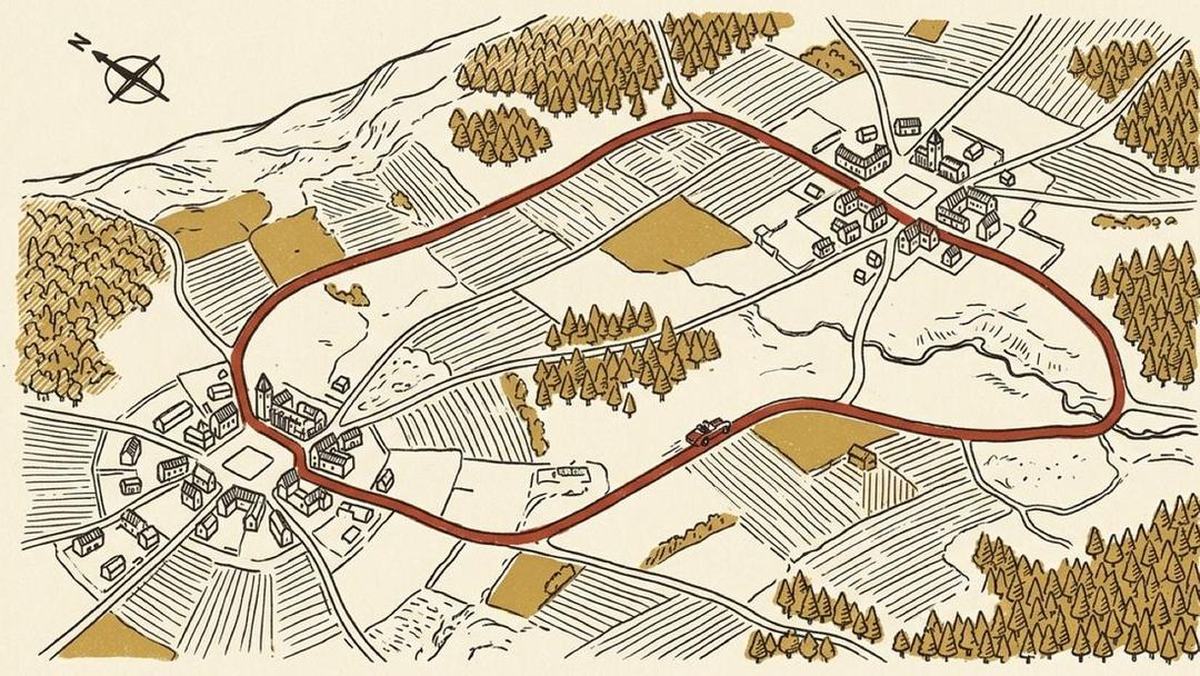
A GPX file has a first point and a last point, because a file is a list and lists have ends. A ring road does not. Its first point is an accident of where somebody happened to press record, and there is no reason at all for that to be near you when you want to drive it.
This is a small problem that turns into a large annoyance. You are parked in a village on the north side of the loop. The recording starts in a village on the south side. Hand the file to almost any navigation app and the first thing it will do is send you forty minutes across the middle to reach "the start", so that you can then drive the whole ring and end up back at the start, forty minutes from your car.
Rotating the ring to meet you
Roadbook '71 does not have a start. When you tap Start, it finds the point on the ring closest to where you actually are and treats that as the beginning. The route is rotated so that it runs from there, all the way round, and back to the same point.
Because it is a ring, this costs nothing. Every metre of the loop is still driven, in the same direction, in the same order, and the sequence just begins at a different place in the cycle. You set off from where you are standing, and the drive ends where the drive began.
If the track is not a loop (an out-and-back, a point-to-point, a one-way run down a valley), rotation would be meaningless, so the app aims the first leg at the nearest point on the line and picks the route up from there. Either way, the first instruction is one you can actually follow from where the car is parked.
What the join looks like on the page
The roadbook is written from the join. Distances count up from zero at the point you joined, and the last line of the book is the same place with the full distance of the loop next to it. On the sample loop that is 45.70 km against a line that reads "back at the join".
On the car screen the whole ring is drawn on the map before you set off, with the car sitting beside it. Tap Go and the guidance starts from the nearest point rather than from a village you have never heard of.
One consequence worth knowing: if you start the drive some distance from the loop, in the car park of a café two kilometres away, say, the app will guide you to the ring first and tell you it is doing that. The instruction is prefixed so that the car screen never shows "Turn left onto Peeshoek" in a way that implies the loop has begun when you are still driving out to it. Knowing whether you are on the ride or on the way to the ride is a real distinction, and the app keeps it.
Stopping in the middle
Long drives are not continuous. You stop for lunch, or because the weather turned, or because two thirds of the way round is enough for one day.
None of these should cost you the drive, so a drive in progress is written to disk continuously as it goes, rather than on a timer or when the app is politely closed. The reason is unglamorous: a navigation app that has been in the background for two hours with the screen off is exactly the kind of process iOS terminates when it needs memory. If that termination lost your position, the app would be untrustworthy on precisely the drives it exists for.
So you can come back to it. Open the app an hour later or three days later and the drive is where you left it, with the kilometres you have already covered still counted. Pick it up from wherever you happen to be. You do not have to return to the exact spot you stopped at, because the app matches you back onto the route.
Progress on the page and on the recording
While you drive, the part of the loop behind you is inked in on the computed route and on the raw recording underneath it. Both lines carry progress, in different weights, because they are answering different questions. The route line says "this is where the instructions have taken you". The recording line says "this is how much of the original drive you have now done again".
On the roadbook page it shows up as a rubber stamp: each junction gets signed off as you pass it, and its distance goes from black to green. It is a small thing and the most satisfying part of using the app, the same satisfaction as a co-driver drawing a line through a completed page.
Missing a turn
You will miss turns. On a small road with a junction you were not expecting, everybody does.
When the app notices you have left the route, it does not simply keep telling you to make a turn you have already gone past, and it does not start the loop again. It requests a leg from where you actually are back onto the route and splices that into the plan. The kilometres you had already driven survive the splice: the count does not reset, because you did drive them.
What it deliberately does not do is re-plan the whole loop around your mistake. The loop is the recording, and the recording has not changed. All that is needed is a way back onto it.
The one thing to watch
Rotation depends on the ring genuinely closing. If your recording stops eight hundred metres short of where it started, the app has to decide whether that is a loop with a gap or a line that happens to nearly meet, and it will sometimes decide differently from you.
The fix is at recording time and costs nothing: drive back past your starting point before you stop the recording. A ring closed to within a few metres is unambiguous, and everything else follows from it.